Luraville Springs
Suwannee County
Summary of Features
- Scale -4th magnitude
- Scenery -very good
- How Pristine? -completely unspoiled
- Swimming -no
- Protection -private
- Crowds -none
- Access -private
- Facilities -none
- Scuba -yes


Quick Directions
In the woods almost directly behind the dive shop in Luraville.
Full Directions
From Mayo, drive north on State Road 51. After about 4 miles, cross the Suwannee River. The flashing light at Luraville is another 1-1.5 miles north, just past the agriculture weigh station. There is a country store on the left at the flashing light. Turn right at the light onto Luraville Road and drive to the dive shop about ¼ mile on the right. The springs are on private property to the right and behind the dive shop. They are about 200 yards back or about 0.2 miles southeast of the junction of CR51 and Luraville Road.
Spring Description
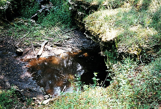
The springs lie in a heavily forested area of secondary growth and flood plain. The two springs are similar in appearance and consist of depressions of 10-15 deep at the bottom of limestone outcrops/overhangs of similar dimensions. On the date of visit, neither spring was flowing, although both had small (a few feet in diameter) dark-water pools. They looked like mud-holes. According to Rosenau et al. (1977, p. 371), the springs feed Irvine Slough when flowing. The slough flows approximately 2 miles SE to the Suwannee River (p. 358).
Use/Access
- The springs are on private property, and the authors were guided to the site by the owner after asking and receiving permission. Trespass is not advised; the owners have large dogs.
- According to the dive shop owner, the unappealing openings lead to the huge Peacock underwater cavern system, which has been mapped for several miles underground.
Personal Impressions
Worth seeing only to be able to check the springs off on our list and know we had been able to see the eponymous springs of Luraville.
Nearby Springs
- Peacock
- Bonnet
- Orange Grove
- Charles
- Allen Mill Pond
- Cow
- Running
- Bathtub
- Convict
- Thomas
- Perry
Other Nearby Natural Features
- Challenge Sink
- Other Sinkholes in Peacock State Recreation Area