Potter Spring
Citrus County
Summary of Features
- Scale—2nd magnitude
- Scenery—fine-excellent
- How Pristine?—completely pristine
- Swimming—poor
- Protection—unknown
- Crowds—none
- Access—good-arduous (depending on tide), canoe only
- Facilities—none
- Safety—good
- Scuba—yes
- Cost—$1.50 to park at campground, extra to rent boat or canoe


Directions
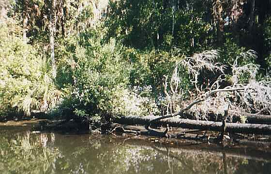
From intersection of U.S. 19 and U.S. 98, go west on Highway 480, a.k.a. Miss Maggie's Drive. Follow 1.7 miles to the end, passing small homes and the Chassahowitzka River Lodge on the right. Turn right at signs for the Chassahowitzka River Campground and follow to headwaters. From the boat ramp, go downriver about two miles, passing the three tree-covered islands and the remains of an old railroad trestle that once crossed the river. The creek is over 300 feet wide at this point, and estuary-like. After the trestle, move to the right (north) side of the river and go perhaps another 800-1,000 feet to mouth of Potter Creek. Paddle (or pole/plow in low tide) up the creek about ¾ mile to the spring at the creek’s headwaters. The water gets somewhat deeper in the run. The bottom becomes shallow and rocky near the spring.
For maps, latitude/longitude data, driving directions, satellite imagery, and topographic representations as well as weather conditions at this spring, go to Greg Johnson's informative "Florida Springs Database" web site at the following address: http://www.ThisWaytothe.Net/springs/floridasprings.htm#Florida
Spring Description
The spring is a semicircular, milky green pool about 100 feet across. There is a large boil on the surface; the bottom is not visible but has been measured as 17 feet deep (Rosenau et al., 1977, p. 90). Below the pool, the run is initially shallow and rocky, but gradually deepens and the bottom becomes sandy and vegetated. Land around the spring and along the run is dense subtropical forest. Herons, egrets, and other waterfowl may be seen in the water and in the trees. Blue crabs were observed in the run. Flow from Ruth Spring enters the back (north) end of the spring from a small opening.
Use/Access
Getting to the spring at low tide requires arduous paddling through the shallow water and sandy bottom. Access is easier at high tide. The nearby Chassahowitzka River Campground includes primitive and modern camping, a camp store, boat rentals, a telephone, and restrooms. Canoes can be rented for a reasonable fee.
The Chassahowitzka National Wildlife Refuge begins about two miles below this spring. It is accessible only by boat, and is closed to human visitors from October 15-February 15 each year to protect wildlife. The refuge provides sanctuary for 250 species of birds, over 40 types of reptiles and amphibians, and more than 25 types of mammals ("Chass. National Wildlife Refuge," U.S.F.W.S., n.d.).
Springiana
xxxxx
Personal Impressions
xxxxx
Nearby Springs
- Other Chassahowitzka River springs (Chassahowitzka Main Spring, Crab Creek Springs, Lettuce Spring, Houseboat Spring, Salt Springs, Solution Holes, The Crack, Ruth Spring, Beteejay Spring, Blue Run Spring)
- Blue Spring
- Crystal River
- Homosassa Springs
- Weeki Wachee Spring
- Rainbow Springs
Other Nearby Natural Features
- Withlacoochie State Forest
- Fort Cooper State Park
- Homosassa Springs State Wildlife Park
- Crystal River State Archeological Site
- Rainbow Springs State Park
- Cedar Keys National Wildlife Refuge